Customers and partners of Wallenius Wilhelmsen Ocean (WW Ocean) are now able to use new-look trade maps resembling public transit maps, providing a new level of transparency to WW Ocean’s global network
Maps of the global liner network include easy-to-spot hubs that provide connection points for multiple voyages, while transshipment options – from both WW Ocean and selected third-parties – are clearly marked.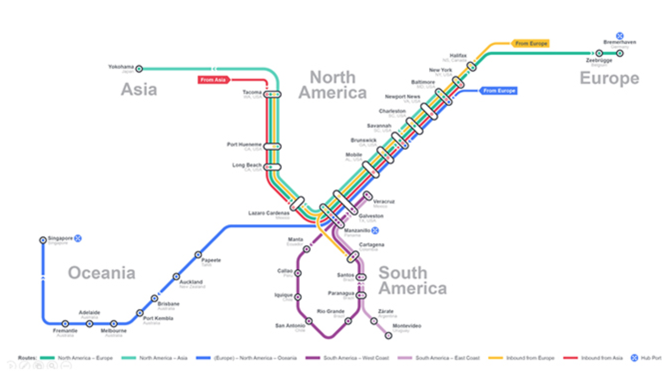 A range of maps are available giving customers a choice of detail. The high-level trade maps show global trade routes and how they related to one another.
The detailed trade maps help to visualize export (load and discharge ports) and import (discharge ports only) and show the different routes that make up the trade. For example, Europe to North America trade route consists of a total of five different routes.